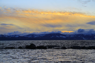
Emerald Bay, Lake Tahoe
Lake Tahoe is one of a kind landscapes in America
The
region and mountains were formed first by a normal fault from the North American
Plate to the Pacific plate colliding, during the subduction phase many volcanoes and
granite formed. The steep landscape, batholiths, and intrusive rocks found in the region support
this formation. The depth of Lake Tahoe was
later formed by two smaller faults on the shorelines that sunk the graben land
in thousands of feet. Forming what is Lake Tahoe today. The last Glacier period for Tahoe ended
10,000 years ago.
A view of a Col, western side of Tahoe
 These glaciers forced boulders, or till, out to form a terminal moraines, where water was blocked from lake Tahoe and formed
What will the landscape of Tahoe look like in the future?
The eastern shoreline, flatter then the west
In 1,000 years ...
I predict that Lake Tahoe's eastern
side will have flattened out more because of the mass wasting and the snow
that are left now year around will melt and drown the Truckee
river valley. The eastern end of the lake on the leeward side of the mountain experiences
both extreme cold and hot temperatures during the seasons. The mountains are
mostly wasting from frost weathering, pressure release of the large rocks, or
root weathering. But because of the rainshowdow effect on th eleeward side of the mountain range mudflows and debris flows continously occur, erroding the shoreline into the lake. Once the western side of the lake continues(like the present) to become flat it will not get
the same amount of percipitation because it does not have the eastern mountain side
to hold the moisture from the storms in.
Reno/Truckee veiw of Seierra's
The vegetation life will be much like Reno South Lake Tahoe
In 10,000 years...
I predict that we will be exiting
the mini ice age scientist say we are entering. I think the Canadian
valley's. Summer snow in Tahoe
I feel the earth will start moving again and
the four different fault lines that fall underneath tahoe basin will move. Sierra mountain range will rise
higher then before to 20,000 feet with volcanoes melting all the glaciers.
Present day you can find the basalt lava flows on the western side of the lake
where the mountains rose to 15,000 feet.
Eagle Rock found in Tahoe Basin. Evidence of volcanic basalt flow.

The lake will expand in depth and
width with the movement of the two shoreline faults opening up a eastern valley and flooding Reno , Nevada
Westside of Lake Tahoe
Sources:
http://www.tahoeadventuresports.com/misc/tahoefacts.htm
http://motherearthtravel.com/united_states/lake_tahoe/history.htm
http://clasfaculty.ucdenver.edu/callen/1202/Landscapes/Glac/Glac.htm
http://english.pravda.ru/science/earth/11-01-2009/106922-earth_ice_age-0/
http://www.bing.com/images/search?q=overview+of+tahoe+to+reno&view=detail&id=AA9754B8C8403743E41D9B5C9482B71BFF32C062
Photo by Parker Alexander


No comments:
Post a Comment