Friday, November 30, 2012


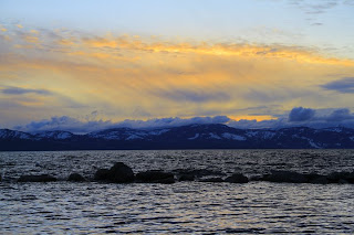
 Emerald Bay, Lake Tahoe
Lake Tahoe is one of a kind landscapes in America.
         The region and mountains were formed first by a normal fault from the North American Plate to the Pacific plate colliding,  during the subduction phase many volcanoes and granite formed. The steep landscape, batholiths, and intrusive rocks found in the region support this formation. The depth of Lake Tahoe was later formed by two smaller faults on the shorelines that sunk the graben land in thousands of feet. Forming what is  Lake Tahoe today. The last Glacier period for Tahoe ended 10,000 years ago.
          A view of a Col, western side of Tahoe
These glaciers forced boulders, or till, out to form a terminal moraines, where water was blocked from lake Tahoe and formed Fallen LeafLake. Emerald Bayexpose's evidence of a glacier with Cirques, the bowl like landforms, Many little lakes called tarns are present. Some Col's that are seen show the passing between glaciers. Alongside those Col's are several U-shaped valleys. There seems to be only smaller horns on the Emerald Bay side of the lake.
 
 
Fallen Leaf Lake 
 
 What will the landscape of Tahoe look like in the future? 
 The eastern shoreline, flatter then the west
In 1,000 years ...
 I predict that Lake Tahoe's eastern side will have flattened out more because of the mass wasting and the snow that are left now year around will melt and drown the Truckee river valley. The eastern end of the lake on the leeward side of the mountain experiences both extreme cold and hot temperatures during the seasons. The mountains are mostly wasting from frost weathering, pressure release of the large rocks, or root weathering. But because of the rainshowdow effect on th eleeward side of the mountain range mudflows and debris flows continously occur, erroding the shoreline into the lake. Once the western side of the lake continues(like the present) to become flat it will not get the same amount of percipitation because it does not have the eastern mountain side to hold the moisture from the storms in.
                                                                                            Reno/Truckee veiw of Seierra's
 
 The vegetation life will be much like Reno's desert weather today. I feel that the water will be highly permeable as humanity continues to pollute the water. The South Lake Tahoe city has moved up on the mountain because the water level rose with the melting of the glaciers and flooded the basin.


In 10,000 years...
 I predict that we will be exiting the mini ice age scientist say we are entering. I think the Canadian glacier will not reach Tahoe but because global temperatures have fallen and with the regions high elevation glaciers are able to form and cover, once again, the basin and
valley's.                                                    Summer snow in Tahoe
 
 At 1,000,000 years...
 I feel the earth will start moving again and the four different fault lines that fall underneath tahoe basin will move. Sierra mountain range will rise higher then before to 20,000 feet with volcanoes melting all the glaciers. Present day you can find the basalt lava flows on the western side of the lake where the mountains rose to 15,000 feet.


Eagle Rock found in Tahoe Basin. Evidence of volcanic basalt flow.


The lake will expand in depth and width with the movement of the two shoreline faults opening up a eastern valley and flooding Reno, Nevada.
                                                                Westside of Lake Tahoe
 

Sources:

http://www.tahoeadventuresports.com/misc/tahoefacts.htm

http://motherearthtravel.com/united_states/lake_tahoe/history.htm

http://clasfaculty.ucdenver.edu/callen/1202/Landscapes/Glac/Glac.htm

http://english.pravda.ru/science/earth/11-01-2009/106922-earth_ice_age-0/

http://www.bing.com/images/search?q=overview+of+tahoe+to+reno&view=detail&id=AA9754B8C8403743E41D9B5C9482B71BFF32C062


Photo by Parker Alexander

Wednesday, November 7, 2012

Lightning In Lake Tahoe
 
               Lightning strikes across the lake. The sky above the storm filled with negative particles, in the mature part of the storm, will light up when the stepped leader is looking for positive particles on the ground to connect with(in the clip in slow motion the stepped leader can be seen). The forked lightning comes down and the traveling spark connects to the positive part it selected on the ground. Click HERE to watch the clip.

Clouds around Lake Tahoe
Photo's by Parker Alexander 
 The lake is found on the leeward side of the Sierra Mountain range. The summer season is hot and dry and the winter is cold and dry.
 
 Orographic lifting occurs on the Sierra mountain range. The leeward side of the mountain receives rain shadows and Chinook winds. Being the dry side with desert conditions in Reno the area has a large lake at the bottom of the mountain that creates different weather patterns. The storms leaving the windward side of the mountain are carried over by the Chinook winds, if the clouds pick up the moisture over the lake it can create unusually large storms for the region. Large storms  mostly occur in Tahoe in the winter and spring.
    With surface elevation of 6,225 ft the cumulus clouds form closer over the lake. Cumulonimbus clouds have the characteristics of puffy, large, storm clouds that form anvil shapes. In these clouds, the strong updrafts bring water molecules into a cycle coming up with the drafts, freezing, then coming back down to only be taken back by the updrafts. Each trip back up into the cloud allows the hail to freeze again, which adds size with a ring like layers to the hail. The hail drops to the ground when it is to heavy to be swept up. 

 The bottom of clouds are flat because that is the level of dew point. The air is trying to achieve condensation at the dew point.
 
 
With surface elevation of 6,225 ft the cumulus clouds form closer over the lake.
 
When jets or planes travel through, from the local Tahoe or close Reno airport, in the sky energy is released in a form of heat. That heat condenses in different temperatures revealing the path of contrails in the sky.


Sources:
 
Information:

Saturday, October 6, 2012

Hydrology around Lake Tahoe
 
 Apart of the water table displays the level of surface water. Surface water consisits of water that flows into lakes. Little amount of ground water is found at the bottom of streams. Rocks, trees, and plant life show where ther water tables exists during the changing seasons.

Photo By: Parker Alexander


 Photo By: Parker Alexander
Physical Weathering
 
Pressure Roots are examples of how rocks and minerals break apart. Inside the rocks fissures, sand or clay particles gather. Seeds travel from birds or the wind into the fissures. With the sun and water, seeds grow roots into the cracks that expand the rock further. Pressure roots can have an impact to break a rock in half.
 
Lake Tahoe's Mass Waisting
 
 
Landslide in California, Lake Tahoe across Route 50.


In Emerald Bay, Lake Tahoe, during an intense rain the permeable soil passed it's retention point allowing the soil to transport rocks and mud down the slope in a landslide.

Angular slope material that are not smooth or round are colluviums. Looking around the steep mountain sides colluviums are apparent.

Mass waisting can occur in falls. Rocks Falls form Talus, groups of fallen rock, that create the jagged look across the landscape.
 
Sources:

Friday, September 14, 2012


       Lake Tahoe is the 10th Deepest Lake in the World!       
               The Highest Lake in the United States!


 Lake Tahoe Basin is between the Carson's Range and the Sierra Nevada Mountains. These mountains show where the normal fault occurred arguably 2-4 million years ago.        


The lake was formed by the downward movement of the ground along the fault known as grabens. The upward shift of the ground formed the ridges or mountains around the lake that are called horsts. One can find fault lines across the northern and western parts of the lake floor.  
 
 
There is mostly shale, fine grained sediment, like mud and clay found in the area of the lake but in the north end there is siltstone from silt and sand.

 This intrusive rock in the picture to the left of felsic material or the lighter patches is seen next to the lizards. 
 
 The surrounding mountains provide runoffs from the snow melting into the lake during the seasons. Over the years, the runoffs have brought down sediment rocks that add to the basin. Runoffs can be apart of something larger called triangular facets. Triangular facets are true indicators of a normal fault along a mountain range.The large lake has many  running into it but Lake Tahoe is only drained by the Truckee river.


             On the Sierra Nevada's there are batholiths from an andesitic volcano. Batholiths are created by an abundance of large chamber's called plutons formed in this case by erosion. Exposed granite, the lighter felsic igneous rock can indicate batholiths. Also, on the mountain sides there has been discoveries of prebatholth or metamorphic rocks.


Across the Lake and basin is the view of the ridged mountain line or horsts and the graben was filled with water.

                        Sources

http://tahoe.usgs.gov/files/papers_morphology.pdf

http://clasfaculty.ucdenver.edu/callen/1202/Battle/Build/Faulting/Faulting.html

http://tahoe.usgs.gov/facts.html

 
Photographs by Parker Alexander


Thursday, August 23, 2012


            KEEP TAHOE BLUE!


                     My name is Farrah Chapman. I used to live in South Lake Tahoe, CA. Everyday of the year I am taken back by Lake Tahoe's beauty.

             When living there I found that preserving the large beauty was a priority by the locals. Keep Tahoe blue was everywhere and that blue bumper sticker is there stand. From the Sierra Mountain range to the second deepest lake in the US, Tahoe is a true fascination on it's own. I am even more interested in Tahoe because the bottom of the lake is still somewhat of a mystery. Made out of the glacier water run off from the Sierra's, the water has many elements of danger with the cold water temperatures.
              This has brought me to my blog. How was the land and lake formed? How does Tahoe continue to change? This natural beauty is filled with the wonders of physical geography and this blog will break down some of those wonders.


Photo's provided by Parker Alexander.